


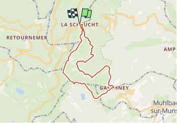
F798-la Schlucht-Sentier des Roches par le Gaschney

geranimo
User

Length
13.6 km

Max alt
1355 m

Uphill gradient
660 m
Km-Effort
22 km

Min alt
957 m

Downhill gradient
659 m
Boucle
Yes
Creation date :
2017-01-03 00:00:00.0
Updated on :
2023-02-17 17:03:15.606
13h18
Difficulty : Difficult

FREE GPS app for hiking
 SityTrail
IGN / Geographical institutes
SityTrail Plus
The world is yours!
About
Trail Walking of 13.6 km to be discovered at Grand Est, Vosges, Le Valtin. This trail is proposed by geranimo.
Positioning
Country:
France
Region :
Grand Est
Department/Province :
Vosges
Municipality :
Le Valtin
Location:
Unknown
Start:(Dec)
Start:(UTM)
352682 ; 5325290 (32U) N.
Comments